History
Fourteen thousand years by the salt water
From a mastodon hunt near Sequim to salmon swimming back up the Elwha: twenty moments in the Northwest's story, on a map that fills in as you scroll.
Here first, and here now
The Northwest's first peoples have lived here since time immemorial, and they are here today. Washington alone is home to 29 federally recognized tribes, and to peoples still seeking recognition, like the Duwamish, the host tribe of Seattle.
Coast Salish peoples, among them the Suquamish, Muckleshoot, Nisqually, Tulalip and Lummi, live around the Salish Sea. The Makah, the Cape People, live at Neah Bay on the northwest tip. The Quinault live on the coast; the Yakama, the twelve bands of the Colville and the Spokane live east of the mountains; the Nez Perce, the Nimiipuu, live just over the line in Idaho.
Each nation tells its own story best. Their own websites are on the Sources page.
Twenty moments
-
Nearly 14,000 years ago
Near what is now Sequim, hunters bring down a mastodon. The tip of a bone spear is still lodged in one of its ribs: the oldest bone projectile point found in the Americas.
Sources: HistoryLink.org, Texas A&M
-
About 500 years ago
A mudslide buries part of Ozette, a Makah village on the outer coast. A storm uncovers it in 1970, and an eleven-year dig with the Makah brings up more than 55,000 objects. The tribe keeps them at its own museum in Neah Bay.
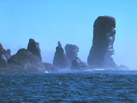
Cape Flattery, the Makah's northwest tip. NOAA, public domain -
26 January 1700
About nine at night, a giant earthquake shakes the whole coast. Its tsunami crosses the Pacific and reaches Japan, where it is written down. The Hoh and the Makah keep the memory in their stories.
-
May 1792
Robert Gray sails the Columbia Rediviva over the bar into the great river and names it Columbia. Eighteen days later, anchored off Restoration Point, George Vancouver names "Puget's Sound" for his lieutenant, Peter Puget. The salt water already had a name: in Lushootseed it is x̌ʷəlč.
Restoration Point Mouth of the Columbia
Sources: HistoryLink.org, HistoryLink.org
-
Autumn 1805
The Nez Perce welcome the worn-out Lewis and Clark expedition, show them how to burn out dugout canoes and look after their 38 horses. On 7 November, near Pillar Rock, Clark writes "Ocian in view! O! the joy." The ocean is still about 20 miles away.
Sources: National Park Service, National Park Service, HistoryLink.org
-
15 June 1846
Britain and the United States sign the Oregon Treaty. The border runs along the 49th parallel, then bends round the southern tip of Vancouver Island.
Sources: HistoryLink.org
-
13 November 1851
The Denny Party lands at Alki Point from the schooner Exact, in the homeland of the Duwamish. The town they start takes the name of Si'ahl, a leader of the Duwamish and the Suquamish: Seattle.
Sources: HistoryLink.org, HistoryLink.org, Duwamish Tribe
-
2 March 1853
President Millard Fillmore signs the bill creating Washington Territory. It was nearly Columbia Territory; Congress changed the name so no one would mix it up with the District of Columbia.
Sources: HistoryLink.org
-
1854 to 1855
At treaty councils from Medicine Creek to Walla Walla, Governor Isaac Stevens has the tribes cede most of their lands. Every treaty keeps their right to fish "at all usual and accustomed grounds and stations."
Sources: HistoryLink.org, National Park Service, UW School of Law
-
1855 to 1858
War follows, on both sides of the mountains, between settlers and soldiers and warriors from many tribes. The Nisqually leader Leschi is hanged at Steilacoom in 1858. In 2004 a historical court clears his name.
Sources: HistoryLink.org, HistoryLink.org, National Park Service
-
11 November 1889
Washington becomes the 42nd state. President Benjamin Harrison signs the proclamation with a pen of Washington gold.
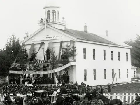
The Territorial Capitol in Olympia, dressed for statehood. A. D. Rogers, public domain Sources: HistoryLink.org
-
17 July 1897
The steamer Portland docks in Seattle with 68 miners and their Klondike gold. The papers said a ton. It was nearer two.
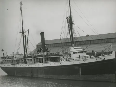
The Portland in Elliott Bay, about 1900. Webster & Stevens, public domain Klondike Gold Rush park, Seattle
Sources: HistoryLink.org
-
29 June 1938
Olympic National Park is born, and the wild coast joins it in 1953. Today it is a World Heritage Site, on the traditional lands of the Skokomish, Klallam, Makah, Quileute, Hoh, Queets and Quinault peoples.
Sources: HistoryLink.org
-
1942
Grand Coulee Dam is finished on the Columbia: 550 feet high, nearly a mile long, and still the largest hydropower producer in the United States.
Sources: National Park Service
-
1 June 1951
Washington State Ferries takes over the Black Ball Line's boats. Today it is the largest ferry system in the country: 21 ferries and 20 terminals.
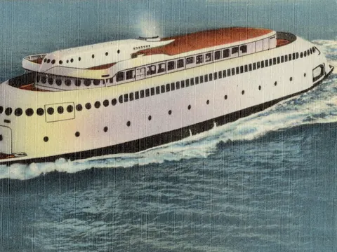
The streamlined Kalakala on an old postcard. C. P. Johnston Co., public domain Sources: HistoryLink.org, WSDOT
-
21 April 1962
The Century 21 Exposition opens in Seattle. By 21 October close to ten million people have come, and the city keeps the Space Needle and the Monorail.
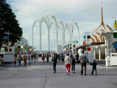
The fairgrounds in 1962. Seattle Municipal Archives, CC BY 2.0 Sources: HistoryLink.org
-
12 February 1974
Judge George Boldt rules that the treaty tribes keep their right to fish at their usual and accustomed places, and to half the catch. The Supreme Court largely upholds it in 1979.
Frank's Landing, on the Nisqually
Sources: HistoryLink.org, HistoryLink.org
-
18 May 1980
At 8:32 in the morning Mount St. Helens erupts. Fifty-seven people die, and the mountain loses 1,314 feet off its top.
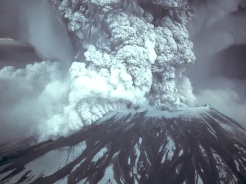
The eruption column, 18 May 1980. Austin Post, USGS, public domain Sources: USGS
-
Winter 1998 to 1999
The Mt. Baker Ski Area measures 1,140 inches of snow in one season. That is 95 feet, and still the world record.
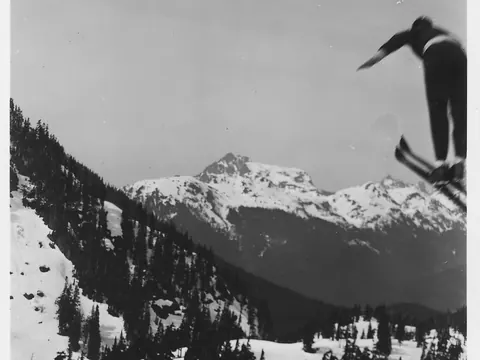
A jumper at Heather Meadows, Mount Baker, in 1936. U.S. Forest Service, public domain Sources: Mt. Baker Ski Area, The Seattle Times
-
2011 to 2014
Two dams come out of the Elwha River. Glines Canyon, 210 feet tall, is still the tallest dam ever removed in the United States, and salmon are back in the river of the Lower Elwha Klallam Tribe.
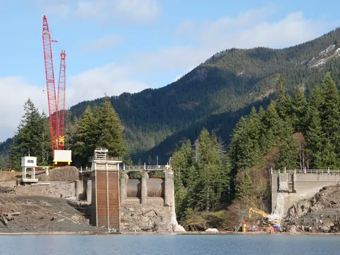
Glines Canyon Dam coming apart, March 2012. J. Burger, NPS, public domain Sources: National Park Service, National Park Service

.jpg)
,_ca._1900_-_DPLA_-_106f9828b9e76ef4e8519c335b80f08e.jpg)
.jpg)
.jpg)


_(17139325269).jpg)
And today the mountain is out, now and then
The tribes still fish at their usual and accustomed places. The ferries still cross. And on a clear day, Rainier still fills the sky.